• Hi Guest!
    You can help ensure that British Car Forum (BCF) continues to provide a great place to engage in the British car hobby! If you find BCF a beneficial community, please consider supporting our efforts with a subscription.

    There are some perks with a member upgrade!
    **Upgrade Now**
    (PS: Subscribers don't see this gawd-aweful banner
Tips
Tips

Group statistics

Members:
18
Threads:
1714
Messages:
4149
Discussions:
3
Photos:
94

Latest posts

Group events

Photography

Got 'im!!

DrEntropy

Great Pumpkin
Platinum
Country flag
Offline
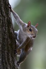
Our resident tree rodent. This was with the AF 80~400mm 1:4.5-5.6D ED, full extension, 1/160th at ∱5.6, ISO 2500. Hand-held with VR. This is full frame, the jpeg scaled and nothing done to it in warez.

I was considering letting this lens go, but this shot has me convinced to hang onto it for a while:

Ninja Squirrel!
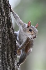
SS5_3094sc.JPG
 
After a bit of Darktable tweaking:

SS5_3094Dshsc.jpg
 
That shot needs some carabineers and a chalk bag.
 
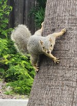
They're devious on both sides of the country!
 
Our resident tree rodent. This was with the AF 80~400mm 1:4.5-5.6D ED, full extension, 1/160th at ∱5.6, ISO 2500. Hand-held with VR. This is full frame, the jpeg scaled and nothing done to it in warez.

I was considering letting this lens go, but this shot has me convinced to hang onto it for a while:

Ninja Squirrel!

View attachment 91251
Seem like Mission Impossible theme music would be appropriate.
 
Waiting for the Big Blow "Idalia" the resident miniature buffalo seems unconcerned.

SS5_3402DGcrsc.jpg
 
It does look like a cat 3 coming ashore near you.
As of now, the prognosticators think it'll be just north of us when it makes landfall, that could change overnight. If it follows the latest prediction it'll be 105~115 MPH winds/rain from our south, storm surge should be well below getting us. These storms are capricious, it's a crapshoot until later tomorrow. There's apparently a low pressure system north and inland that could push the thing right up our a**. On top of that the high tides will be higher than usual, so the surge will be amplified. It'd take a 20' one to get to us in any significant way. But no matter what, we'll have some damage to contend with, for sure.

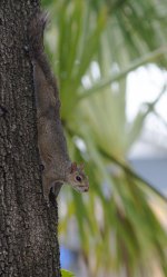
MB is still on the same side of the tree.
Li'l bastage seems to favor an eastern view of things. We'll see how well he fares in a 100-knot gale!!
 
Oh, and to add insult, some bright spark at the Port of Tampa fuel distribution center has "mistakenly" pumped diesel fuel into a batch of gasoline and it was distributed around the gas stations in the area. Saturday, if anyone pumped gas into their car after 10AM at a 7-11 or Citgo station, they're not going too far before injectors and CAT converters go FUBAR.
 
I had heard that on the news. Hopefully not too many people will fall victim to that as they get on the freeway heading North.
 
How's life Doc?
 
Back
Top